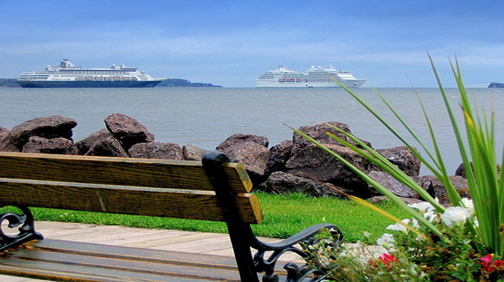
Canada is a dynamic country with countless business opportunities.
As the 10th world powerful country, Canada gives immigrants a chance to be part of its economic growth.
Canada and its Economy
Canada is the 10th world’s largest economic power. With its GDP as high as CA $ 182.5 billion (2013), Canada offers one of the best economic freedom in the world. Canada is a member of the Organisation for Economic Co-operation and Development (OECD) and part of the The Group of Eight (G8).
Canada can be proud of its numerous businesses and creators which are worldly renowned for their expertise and innovation. Hydro-Quebec, SunCore Energy, SCN-Lavalin, Cirque du Soleil, McCain Foods, Transcontinental, Bombardier and EnCan are few of the many Canadian businesses that flourish within Canada and abroad.
Although the economy of Canada is dominated by the tertiary sector, or the service industry, it is also very rich in the natural resources.
Canada is a vast country with many resources varying large from one area to another. For example, British-Columbia, the West of the country, is endowed with a rich forest resource. Whereas the central provinces such as Alberta and Saskatchewan are recognized for their industry of gas. Ontario is known for its mines and the car industry, Quebec for hydroelectricity and the Atlantic provinces for their fishing industry.
Canada is also quite an important player in the production of gold, nickel, uranium and lead, and as well as a large exporter of agricultural products.
Canada and its Geography
Total surface area of Canada is 9,984,670 square kilometres. In terms of surface, Canada is the second largest country in the world, right after Russia. Canada is surrounded by the Pacific, Atlantic and Antarctica oceans and shares its border with the United States.
Canada consists of 10 provinces and 3 territories. Canada’s federal structure divides government responsibilities between the federal government and provinces. Some powers are exclusively relevant to the federal government while some others are shared between the two levels such as immigration.

Administrative map of Canada
Montreal (Quebec)
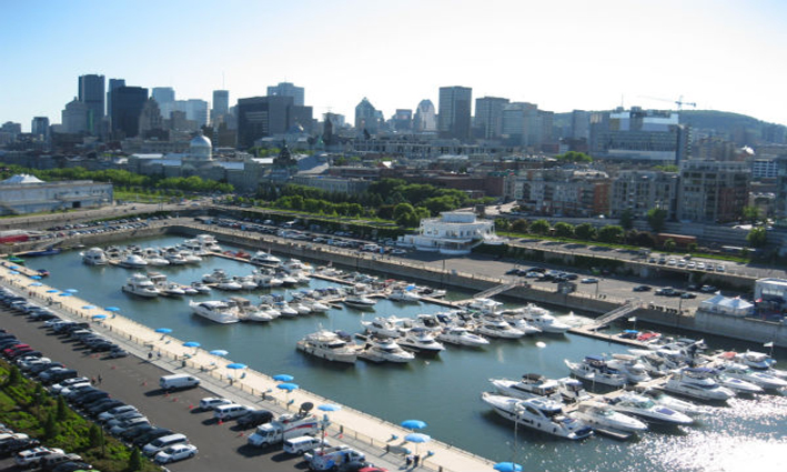
Montreal is a city in the Canadian province of Quebec. It is the largest city in the province, the second-largest in Canada and the 9th-largest in North America. Originally called Ville-Marie, or “City of Mary”,it is named after Mount Royal,the triple-peaked hill in the heart of the city. The city is on the Island of Montreal, which took its name from the same source as the city, and a few much smaller peripheral islands, the largest of which is Île Bizard.
In 2011 the city had a population of 1,649,519. Montreal’s metropolitan area (CMA) (land area 4,259 square kilometres (1,644 sq mi)) had a population of 3,824,221 and a population of 1,886,481 in the urban agglomeration, all of the municipalities on the Island of Montreal included.
French is the city’s official language and is the language spoken at home, as Québécois French, by 56.9% of the population of the city, followed by English at 18.6% and 19.8% other languages (in the 2006 census). In the larger Montreal Census Metropolitan Area, 67.9% of the population speaks French at home, compared to 16.5% who speak English. Montreal is one of the most bilingual cities in Quebec and Canada with 56% of the population able to speak both English and French. Montreal is the second largest primarily French-speaking city in the world, after Paris.
Montreal was named a UNESCO City of Design. Historically the commercial capital of Canada, it was surpassed in population and economic strength by Toronto in the 1970s. It remains an important centre of commerce, aerospace, finance, pharmaceuticals, technology, design, culture, tourism, gaming, film and world affairs.
In 2009, Montreal was named North America’s leading host city for international association events, according to the 2009 preliminary rankings of the International Congress and Convention Association (ICCA). In 2012, QS World University Rankings ranked Montreal the 10th-best place in the world to be a university student.
Toronto (Ontario)
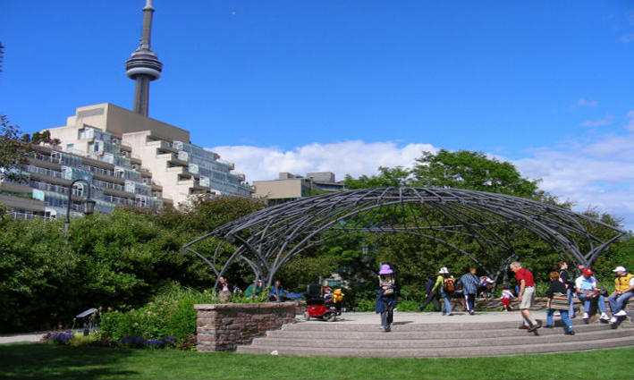
Toronto is the most populous city in Canada and the provincial capital of Ontario. It is located in Southern Ontario on the northwestern shore of Lake Ontario. The history of Toronto began in the late 18th century when the British Crown purchased its land from the Mississaugas of the New Credit. The settlement established there became York, which lieutenant governor John Graves Simcoe designated as the capital of Upper Canada. The city was ransacked in the Battle of York during the War of 1812. In 1834, York became a city and renamed to Toronto. It was damaged in two huge fires in 1849 and 1904. Since 1954, the city occasionally expanded its borders through amalgamation with surrounding municipalities, most recently occurring in 1998.
According to the 2011 Census, the city has 2.6 million residents, making it the fifth-most populous city in North America. However, in 2012, the municipal government published a population estimate of 2,791,140, which led to media reports claiming Toronto as the fourth most populous city in North America and the most populous Great Lakes city, surpassing Chicago. The census metropolitan area (CMA) had a population of 5,583,064, and the Greater Toronto Area (GTA) had a population of 6,054,191 in the 2011 Census. Toronto is at the heart of the Greater Toronto Area, and of the densely populated region in Southern Ontario known as the Golden Horseshoe. Its cosmopolitan and international population reflects its role as an important destination for immigrants to Canada. Toronto is one of the world’s most diverse cities by percentage of non-native-born residents, with about 49% of the population born outside Canada.
As Canada’s commercial capital, it is home to the Toronto Stock Exchange and the five largest banks in the nation. Leading economic sectors in the city include finance, business services, telecommunications, aerospace, transportation, media, arts, publishing, software production, medical research, education, tourism, and engineering. Toronto is considered an alpha world city by the Globalization and World Cities Research Network and is placed among the Global Leaders in the Global Financial Centres Index. The city is also consistently rated as one of the world’s most liveable cities by the Economist Intelligence Unit and the Mercer Quality of Living Survey.
Vancouver (British Columbia)
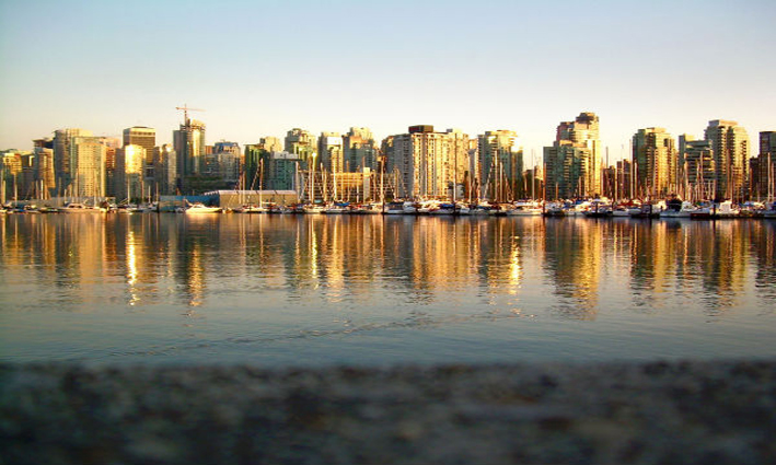
Vancouver, officially the City of Vancouver, is a coastal seaport city on the mainland of British Columbia, Canada. The 2011 census recorded 603,502 people in the city, making it the eighth largest Canadian municipality. Vancouver is one of the most ethnically and linguistically diverse cities in Canada; 52% of its residents have a first language other than English. The Greater Vancouver area of around 2.4 million inhabitants is the third most populous metropolitan area in the country and the most populous in Western Canada. Vancouver is a Beta global city.
The City of Vancouver encompasses a land area of about 114 square kilometres, giving it a population density of about 5,249 people per square kilometre (13,590 per square mile). Vancouver is the most densely populated Canadian municipality, and the fourth most densely populated city over 250,000 residents in North America, behind New York City, San Francisco, and Mexico City.
The original settlement, named Gastown, grew around the Hastings Mill logging sawmill and a nearby tavern, both established in 1867. Enlarging to become the townsite of Granville, with the announcement that the railhead would reach the site it was renamed “Vancouver” and incorporated as a city in 1886. By 1887, the transcontinental railway was extended to the city to take advantage of its large natural seaport, which soon became a vital link in a trade route between the Orient, Eastern Canada, and London. As of 2009, Port Metro Vancouver is the busiest and largest port in Canada, and the most diversified port in North America. While forestry remains its largest industry, Vancouver is well known as an urban centre surrounded by nature, making tourism its second-largest industry. Major film production studios in Vancouver and Burnaby have turned Metro Vancouver into one of the largest film production centres in North America, earning it the film industry nickname, Hollywood North.
Vancouver is consistently named as one of the top five worldwide cities for livability and quality of life, and the Economist Intelligence Unit acknowledged it as the first city to rank among the top-ten of the world’s most liveable cities for five consecutive years. Vancouver has hosted many international conferences and events, including the 1954 British Empire and Commonwealth Games, UN Habitat I, Expo 86, and the World Police and Fire Games in 1989 and 2009. In 2014, following thirty years in California, Vancouver became the indefinite home of the annual TED conference. Canada will host the 2015 FIFA Women’s World Cup, and several matches will be played in Vancouver, including the final at BC Place Stadium. The 2010 Winter Olympics and 2010 Winter Paralympics were held in Vancouver and nearby Whistler, a resort community 125 km (78 mi) north of the city.
Fredericton (New Brunswick)
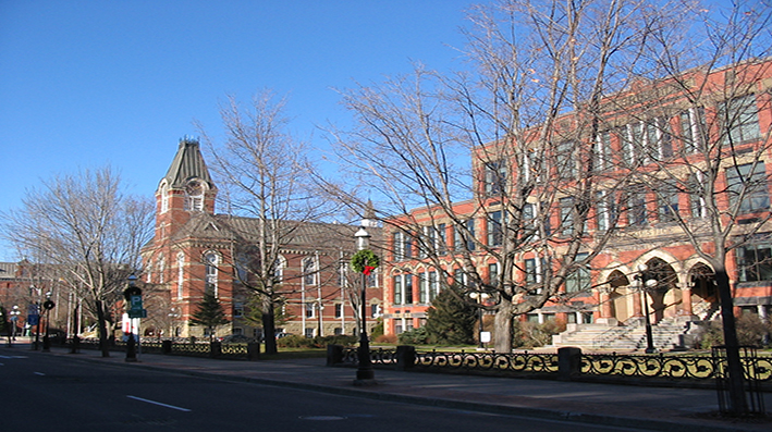
The city is the capital of New Brunswick province. The city is situated in the west-central portion of the province and is one of the main urban centres in southern New Brunswick. In the 2011, the city’s population was 56,224, making it the third largest city in the province after Saint John and Moncton.
An important cultural, artistic, and educational centre for the province, Fredericton is home to two universities: University of Fredericton and St. John University, the New Brunswick College of Craft & Design, and cultural institutions such as the Beaverbrook Art Gallery, the York Sunbury Museum, and The Playhouse—a performing arts venue. The city hosts the annual Harvest Jazz & Blues Festival, attracting regional and international jazz, blues, rock, and world artists.
As a provincial capital, its economy is inextricably tied to the fortunes of the public sector; however, the city also contains a growing IT and commercial sector.
Recently, the New Brunswick government has been seeking to attract more immigrants to the province (and consequently the Fredericton area) to increase the labour force and compensate for an aging population.
The Greater Fredericton Region has also established an investment attraction program called Invest Greater Fredericton. The purpose is to provide investors and site selectors with one central source for economic information such as real estate, demographics, key industries and more.
Halifax (Nova Scotia)
Halifax, formally the Halifax Regional Municipality (HRM), is the capital of the province of Nova Scotia, Canada. The metropolitan area had a population of 390,096 in 2011 with 297,943 in the urban area.Formed by the 1996 amalgamation of Halifax County, the municipality is divided into 18 community planning areas, which are, in turn, divided into over 200 named communities and neighbourhoods, such as the former cities of Dartmouth and Halifax proper.
Halifax is a major economic centre in eastern Canada with a large concentration of government services and private sector companies. Major employers and economic generators include the Department of National Defence, Dalhousie University, the Halifax Shipyard, various levels of government, and the Port of Halifax. Agriculture, fishing, mining, forestry and natural gas extraction are major resource industries found in the rural areas of the municipality. Halifax was ranked by MoneySense magazine as the fourth best place to live in Canada for 2012, placed first on a list of “large cities by quality of life” and placed second in a list of “large cities of the future”, both conducted by fDi Magazine for North and South American cities.
The urban area of Halifax is a major economic centre in eastern Canada with a large concentration of government services and private sector companies. Halifax serves as the business, banking, government and cultural centre for the Maritime region. Major employers and economic generators include the Department of National Defence, as well as the Port of Halifax and Irving Shipbuilding Inc. The municipality has a growing concentration of manufacturing industries and is becoming a major multi-modal transportation hub through growth at the port, the Halifax Stanfield International Airport, and improving rail and highway connections. A real estate boom in recent years has led to numerous new property developments, including the gentrification of some former working-class areas.
Agriculture, fishing, mining, forestry and natural gas extraction are major resource industries found in the rural areas of the municipality. Halifax’s largest agricultural district is in the Musquodoboit Valley; the total number of farms in Halifax is 150, of which 110 are family-owned. Fishing harbours are located along all coastal areas with some having an independent harbour authority, and others being managed as small craft harbours under the federal Department of Fisheries and Oceans.
Charlottetown (Prince Edward Island)
Charlottetown is a Canadian city. It is both the largest city on and the provincial capital of Prince Edward Island, and the county seat of Queens County. Named after Charlotte of Mecklenburg-Strelitz, queen consort of the United Kingdom, Charlottetown was first incorporated as a town in 1855 and designated as a city in 1885. It was most famously the site of the Charlottetown Conference in 1864, the first gathering of Canadian and Maritime statesmen to debate the proposed Maritime Union and the more persuasive British North American Union, now known as Canadian Confederation. From this, the city adopted as its motto “Cunabula Foederis” — “Birthplace of Confederation”.
The population of Charlottetown in the 2011 census was 34,562; this forms the centre of a census agglomeration of 64,487,which is slightly less than half of the province’s population (140,204)
Charlottetown’s economy is dominated by the public sector. The provincial, federal, and municipal levels of government are significant employers in the central part of Queens County, as well as healthcare and secondary and post-secondary education. Technology companies have also been increasing their share of the city’s workforce in the past decade, however the actual numbers are quite small once call-centres are excluded. Other significant economic activities include light manufacturing, such as chemicals, bio-technology, and machining.
St. John’s (Newfoundland and Labrador)
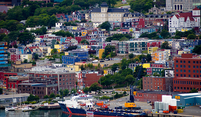
St. John’s is the capital and largest city in Newfoundland and Labrador, Canada. St. John’s was incorporated as a city in 1921, yet is considered by some to be the oldest English-founded city in North America. It is located on the eastern tip of the Avalon Peninsula on the island of Newfoundland.With a population of 200,600 as of 2012, the St. John’s Metropolitan Area is the second largest Census Metropolitan Area (CMA) in Atlantic Canada after Halifax and the 20th largest metropolitan area in Canada. Its name has been attributed to the feast day of John the Baptist, when John Cabot was believed to have sailed into the harbour in 1497, and also to a Basque fishing town with the same name.
St. John’s economy is connected to both its role as the provincial capital of Newfoundland and Labrador and to the ocean. The civil service which is supported by the federal, provincial and municipal governments has been the key to the expansion of the city’s labour force and to the stability of its economy, which supports a sizable retail, service and business sector.The provincial government is the largest employer in the city, followed by Memorial University.With the collapse of the fishing industry in Newfoundland and Labrador in the 1990s the role of the ocean is now tied to what lies beneath it – oil and gas – as opposed to what swims in or travels across it. The city is the centre of the oil and gas industry in Eastern Canada and is one of 19 World Energy Cities. ExxonMobil Canada is headquartered in St. John’s and companies such as Chevron, Husky Energy, Suncor Energy and Statoil have major regional operations in the city. Three major offshore oil developments, Hibernia, Terra Nova and White Rose, are in production off the coast of the city and a fourth development, Hebron, is expected to be producing oil by 2017.
The economy has been growing quickly in recent years. In both 2010 and 2011, the metro area’s gross domestic product (GDP) led 27 other metropolitan areas in the country, according to the Conference Board of Canada, recording growth of 6.6 per cent and 5.8 per cent respectively.At $52,000 the city’s per capita GDP is the second highest out of all major Canadian cities.Economic forecasts suggest that the city will continue its strong economic growth in the coming years not only in the “oceanic” industries mentioned above, but also in tourism and new home construction as the population continues to grow. In May 2011, the city’s unemployment rate fell to 5.6 per cent, the second lowest unemployment rate for a major city in Canada.
St. John’s is also becoming known as an entrepreneurial city. In a 2009 report by the Canadian Federation of Independent Business; Communities in Boom: Canada’s Top Entrepreneurial Cities, St. John’s was ranked the best major city in Atlantic Canada, and 19th overall in Canada for providing a good environment for small business development.
Calgary (Alberta)
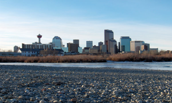
Calgary is a city in the province of Alberta, Canada. It is situated at the confluence of the Bow River and the Elbow River in the south of the province, in an area of foothills and prairie, approximately 80 km (50 mi) east of the front ranges of the Canadian Rockies. At the 2011 census, the City of Calgary had a population of 1,096,833 and a metropolitan population of 1,214,839, making it the largest city in Alberta, and the third-largest municipality and fifth-largest census metropolitan area (CMA) in Canada.
The economy of Calgary includes activity in the energy, financial services, film and television, transportation and logistics, technology, manufacturing, aerospace, health and wellness, retail, and tourism sectors.The Calgary CMA is home to the second-most corporate head offices in Canada among the country’s 800 largest corporations.
Calgary anchors the south end of what Statistics Canada defines as the “Calgary–Edmonton Corridor”.
In 1988, Calgary became the first Canadian city to host the Olympic Winter Games.
Calgary is recognized as a Canadian leader in the oil and gas industry as well as for being a leader in economic expansion. Its high personal and family incomes, low unemployment and high GDP per capita have all benefited from increased sales and prices due to a resource boom, and increasing economic diversification. Because of these strengths, Calgary is designated as a global city by the Globalization and World Cities Research Network. Also, Calgary was one of the top 200 cities worldwide, by the Brookings Institution, that had a top performing local economy for 2011. The city was ranked first nationally, and 51st in the world, in that aspect. Additionally, Calgary was voted third in quality of life among North American cities by the 2011-2012 issue of American Cities of the Future. The Conference Board of Canada forecasts Calgary to lead the country in GDP growth through to 2016.
Regina (Saskatchewan)
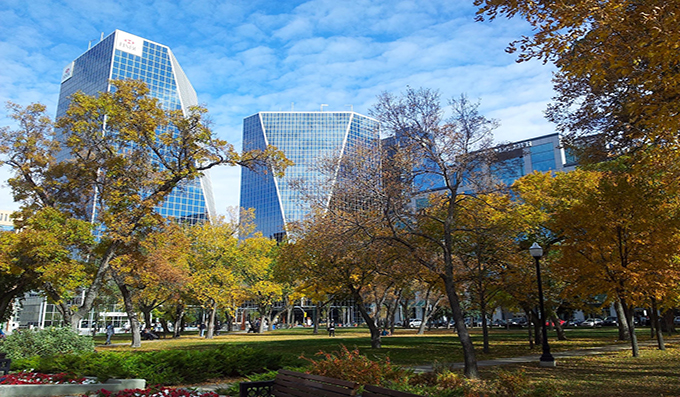
Regina is the capital city of the Canadian province of Saskatchewan. The city is the second-largest in the province and a cultural and commercial centre for southern Saskatchewan. It is governed by Regina City Council. Regina is the cathedral city of the Roman Catholic and Romanian Orthodox Dioceses of Regina and the Anglican Diocese of Qu’Appelle.The city is surrounded by the Rural Municipality of Sherwood No. 159. In 2013, Regina was named the 6th best Canadian mid-sized city (17th best overall) in which to live by MoneySense magazine.
Regina was previously the seat of government of the North-West Territories, of which the current provinces of Saskatchewan and Alberta originally formed part, and of the District of Assiniboia. The site having previously been Wascana (“Buffalo Bones” in Cree), it was renamed in 1882 after Queen Victoria, Victoria Regina, by her daughter Princess Louise, wife of the Marquess of Lorne, then the Governor General of Canada.
Unlike other planned cities in the Canadian West, on its treeless flat plain Regina has few topographical features other than the small spring run-off Wascana Creek. Early planners took advantage of such opportunity by damming the creek to create a decorative lake to the south of the central business district with a dam a block and a half west of the later elaborate 840-foot (260 m) long Albert Street Bridge across the new lake. Regina’s importance was further secured when the new province of Saskatchewan designated the city its capital in 1906. Wascana Centre, created around the focal point of Wascana Lake, remains one of Regina’s attraction and contains the Provincial Legislative Building, both campuses of the University of Regina, the provincial museum of natural history, the Regina Conservatory (in the original Regina College buildings), the Saskatchewan Science Centre, the MacKenzie Art Gallery and the Saskatchewan Centre of the Arts.
Residential neighbourhoods include precincts beyond the historic city centre are historically or socially noteworthy neighbourhoods – namely Lakeview and The Crescents both of which lie directly south of downtown. Immediately to the north of the central business district is the old warehouse district, increasingly the focus of shopping, nightclubs and residential development; as in other western cities of North America, the periphery contains shopping malls and big box stores.
In 1912, the Regina Cyclone destroyed much of the town; in the 1930s, the Regina Riot brought further attention and, in the midst of the 1930s drought and Great Depression, which hit the Canadian Prairies particularly hard with their economic focus on dry land grain farming.The CCF (now the NDP, a major left-wing political party in Canada), formulated its foundation Regina Manifesto, 1933 in Regina.In recent years, Saskatchewan’s agricultural and mineral resources have come into new demand, and it has entered a new period of strong economic growth.
The current estimate of the Regina CMA population, as of July 1, 2013, according to Statistics Canada is 232,090.
Oil and natural gas, potash, kaolin, sodium sulphite and bentonite contribute a great part of Regina and area’s economy. The completion of the train link between eastern Canada and the then-District of Assiniboia in 1885, the development of the high-yielding and early-maturing Marquis strain of wheat and the opening of new grain markets in the United Kingdom established the first impetus for economic development and substantial population settlement.The farm and agricultural component is still a significant part of the economy – the Saskatchewan Wheat Pool (now Viterra Inc.), “the world’s largest grain-handling co-operative” has its headquarters in Regina — but it is no longer the major driver; provincially it has slipped to eighth overall, well behind the natural resources sectors.
Winnipeg (Manitoba)
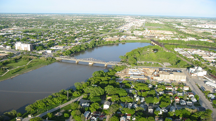
Winnipeg is the capital and largest city of Manitoba, Canada, with a metropolitan population of 730,018 in 2011. Winnipeg is the seventh-largest municipality in Canada, and is the primary municipality of the Winnipeg Capital Region (population of 730,305), with more than half of Manitoba’s population.
Winnipeg lies at the confluence of the Assiniboine and the Red River of the North, a location now known as “The Forks”. This point was at the crossroads of canoe routes travelled by First Nations before European contact. The name Winnipeg is a transcription of the Western Cree word wi-nipe-k meaning “muddy waters”; the area was populated for several thousand years by First Nations. Evidence provided by archaeology,petroglyphs, rock art and oral history indicates that native peoples used the area in prehistoric times for camping, hunting, tool making, fishing, trading and, farther north, for agriculture. Estimates of the date of first settlement in this area are varied and range from 11,500 years ago for a site southwest of the present city to 6,000 years ago at the Forks. In 1805, First Nations peoples were observed engaging in farming activity along the Red River. The practice quickly expanded, driven by the demand by traders for provisions. The rivers provided an extensive transportation network linking northern First Peoples with those to the south along theMissouri and Mississippi Rivers. The Ojibwe made some of the first maps on birch bark, which helped fur traders navigate the waterways of the area.
The economy of Winnipeg includes finance, manufacturing, food and beverage production, culture, retail and tourism sectors. Winnipeg is a transportation hub. Winnipeg’s universities include the University of Manitoba, the University of Winnipeg, Canadian Mennonite University and University of St. Boniface, the oldest post-secondary educational institution in Western Canada.
Winnipeg is culturally diverse. The city has the highest percentage of Filipinos; however, most people in Winnipeg are of European descent. One in ten Winnipeg residents speak both English and French.
Whitehorse (Yukon)
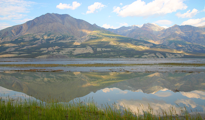
Yukon is the westernmost and smallest of Canada’s three federal territories. Whitehorse is the territorial capital and Yukon’s only city.
The territory was split from the Northwest Territories in 1898. Receiving royal assent on March 27, 2002, the federal government modernized the Yukon Act to confirm “Yukon” as the current standard, though “Yukon Territory” remains the more popular usage. Though officially bilingual (English and French), the Yukon Government also recognizes First Nations languages.
At 5,959 m (19,551 ft), Yukon’s Mount Logan, in Kluane National Park and Reserve, is the highest mountain in Canada and the second-highest on the North American continent (after Denali in the U.S. state of Alaska). The territory’s climate is Arctic in the north (north of Old Crow), subarctic in the central region, between north of Whitehorse and Old Crow, and has a humid continental climate in the far south, south of Whitehorse and in areas close to the British Columbia border. Several rivers run through Yukon, some being the Stewart River, Peel River, and the Yukon River, after which the territory was named.
Yukon’s historical major industry has been mining (lead, zinc, silver, gold, asbestos and copper). The government acquired the land from the Hudson’s Bay Company in 1870 and split it from the Northwest Territories in 1898 to fill the need for local government created by the population influx of the gold rush.
Thousands of these prospectors flooded the territory, creating a colourful period recorded by authors such as Robert W. Service and Jack London. The memory of this period and the early days of the Royal Canadian Mounted Police, as well as the territory’s scenic wonders and outdoor recreation opportunities, makes tourism the second most important industry.
Manufacturing, including furniture, clothing, and handicrafts, follows in importance, along with hydroelectricity. The traditional industries of trapping and fishing have declined. Today, the government sector is by far the biggest employer in the territory, directly employing approximately 5,000 out of a labour force of 12,500.
Yellowknife (Northwest Territories)
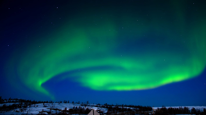
Yellowknife (2011 population: 19,234) is the capital city and largest community of the Northwest Territories (NT or NWT), Canada. It is located on the northern shore of Great Slave Lake, approximately 400 km (250 mi) south of the Arctic Circle, on the west side of Yellowknife Bay near the outlet of the Yellowknife River. Yellowknife and its surrounding water bodies were named after a local Dene tribe once known as the ‘Copper Indians’ or ‘Yellowknife Indians’ (now referred to locally as the Yellowknives Dene (First Nation)) who traded tools made from copper deposits near the Arctic Coast. The current population is ethnically mixed. Of the eleven official languages of the Northwest Territories, five are spoken in significant numbers in Yellowknife: Dene Suline, Dogrib, South and North Slavey, English, and French. In the Dogrib language, the city is known as Somba K’e (Som-ba Kay) (“where the money is”).
The Yellowknife settlement is considered to have been founded in 1934, after gold was found in the area, although the first evidence of a community with commerce did not emerge until 1936. Yellowknife soon became the centre of economic activity in the NWT, and became the capital of the Northwest Territories in 1967. As gold production began to wane, Yellowknife shifted from being a mining town to being a centre of government services in the 1980s. However, with the discovery of diamonds north of Yellowknife in 1991,[9] this shift has begun to reverse.
As the largest city in the Northwest Territories, Yellowknife is the hub for mining, industry, transportation, communications, education, health, tourism, commerce, and government activity in the territory. Historically, Yellowknife’s economic growth came from gold mining, and later government; however, because of falling gold prices and increased operating costs, the final gold mine closed in 2004, marking a turning point for Yellowknife’s economy.
Iqaluit (Nunavut)
Iqaluit is the largest city and territorial capital of the Canadian territory of Nunavut. Formerly Frobisher Bay until 1987, after the name of the bay on whose shore it is sited. Iqaluit is located on the south coast of Baffin Island at the head of Frobisher Bay. As of the 2011 census the population was 6,699, an increase of 8.3 percent from the 2006 census; it has the lowest population of any capital city in Canada. Inhabitants of Iqaluit are called Iqalummiut.
Iqaluit was founded in 1942 as an American air base, intended to provide a stop-over and refueling site for short range aircraft being ferried across the Atlantic to support the war effort in Europe. Iqaluit’s first permanent inhabitant was Nakasuk, an Inuk guide who helped American Air Force planners to choose a site with a large flat area suitable for a landing strip. The wartime airstrip was known as Crystal Two and was part of the Crimson Route. Long regarded as a campsite and fishing spot by the Inuit, the place chosen had traditionally been named Iqaluit – “place of many fish” in Inuktitut – but Canadian and American authorities named it Frobisher Bay, after the name of the body of water it abuts. For the history of the air base, see Frobisher Bay Air Base.
Iqaluit was designated by Canada as the host city for the 2010 meeting of the G7 finance ministers, held on 5–6 February.The meeting strained the northern communications technology infrastructure.
Canada and its Demography
Canada is a vast country populated with men and women of all and possible cultures and races. Multicultural, the population of Canada reaches more than 31,6 million people (Statistics Canada, 2006). Canada has one of the weakest population densities of the world. According to the 2006 census, the density of its population amounted with 3.5 people per square kilometre. Ontario is the most populated province, followed by Quebec, then Alberta and British-Columbia.
Canada and Immigration
According to the last census in 2006, more than 6 million people were born outside of Canada, representing nearly 20% of the whole population. Each year, Canada welcomes thousands of immigrants. Many structured efforts are provided in order to integrate the new Canadian residents within their community. Canada is an open and multicultural society.
Canada and its Services
Canada is a country of service for its citizens.
1. Canadian Charter of rights and freedoms
Canada is a country which protects its citizens. People on the Canadian land are in the obligation to respect the Canadian Charter of rights and freedoms.
2. Bilingual country
Canada is a bilingual country with French and English as its official languages. The great majority of the French-speaking population is concentrated in the province of Quebec, but some significant French-speaking communities exist in Ontario, Manitoba and the Atlantic provinces, particularly in New Brunswick.
3.Access to healthcare
All permanent residents and Canadian citizens have access to the public healthcare system. Each province and territory of Canada manages its own public healthcare system in order to meet the basic medical needs of its population.
4. Access to education
Public education in Canada is within provincial jurisdiction. Education is compulsory up to the age of 16 in every province, except for Ontario and New Brunswick, where it is mandatory until the age of 18.
5. Access to housing
In Canada, you can buy or rent a house. As an owner or a tenant, you have rights and responsibilities.


